
The area of the Cairngorms in northeast Scotland is not an unknown wilderness. Five of the UK’s six highest mountains are all in the park so to say it’s very well-trodden by walkers, tourists, walking tourists is a vast understatement.
Not that you’d want to go walking if you could be there right now.
Right now it’s incredibly snowy, and the locals have it to themselves! Including the staff of the Pine Marten Bar near Aviemore.
On Friday they shared this video of one of the owners snowboarding on Cairn Gorm mountain nearby, showing how much snow has fallen. And I’m so jealous.
But after watching it for the fifth time I realised that in completely different weather back in September I walked where this woman is snowboarding!
It inspired me to go through my photos and pick out some favourites from a few days spent managing to find some remote (or just quiet) spots in one of the most popular parts of Scotland.
Read on for a photo story from a few memorable days spent in the Cairngorms.

- Loch Morlich
A couple of hundred metres from where we were staying at the YHA Cairngorm Lodge lies Loch Morlich, the highest sandy beach in the UK.
In any normal year the campsite next door would have been open and full, and the beach café wouldn’t have had its shutters down with nothing to buy or hire.
But it did mean we had the beach pretty much to ourselves most of the time.
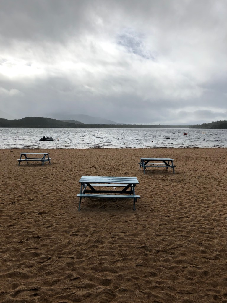
Picnic tables with no-one to perch… We had just arrived and wanted somewhere other than our YHA room to eat lunch. We would have sat down at one of these picnic tables but, as you might be able to tell, the weather was slightly inclement and so we watched the lake and ate our picnic from the dry of the boarded-up beach café behind. Out of shot there were some very inquisitive mallards.

Tempted as I was, I didn’t go for a bracing dip…

The weather was much nicer when we returned two days later, as the evening danced towards sunset. You can walk all round Loch Morlich, though at times you aren’t near enough to see the water.

The sun started to vanish but the blue sky stuck around, dappling itself against the water. This is the point where the River Luineag pours into Loch Morlich. Behind us it snaked away towards Aviemore.
- The Abernathy National Nature Reserve and Ryvoan Pass
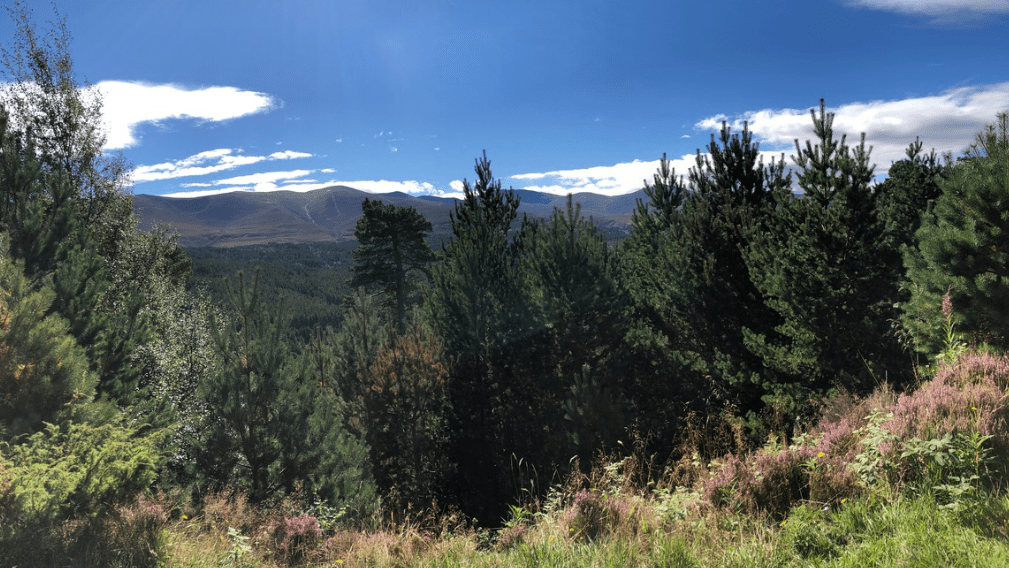
This day I remember being so full of trees! We wanted to walk in some of the ancient Caledonian pine forest that makes this part of the Cairngorms famous.
Spoiler alert: the sky didn’t stay this blue.

The start of our walk was gentle enough…
I dared to say that it was almost too warm, and that I wouldn’t mind a little more cloud cover.

And we discovered just how well pine trees and heather go together. A fairytale might have played out here once, it had that kind of magic air…
From here on it got very rocky, particularly downhill. My brother and I were fine, though our mum had badly sprained her ankle the day before, and we quickly realised that this was perhaps not the best trail to aid her recovery…

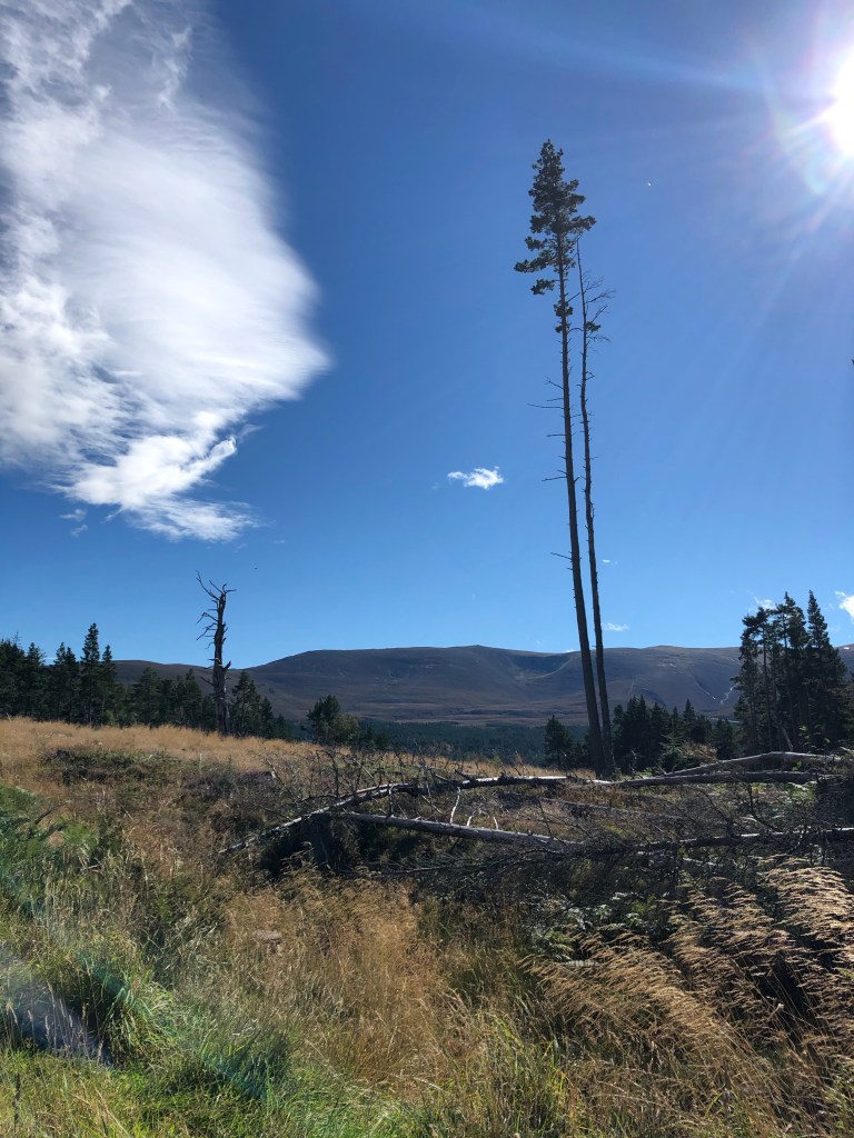
My wish for cloud cover was granted as we arrived at a bothy, marking the start of a new section of the trail, along the Ryvoan Pass and into the Abernathy National Nature Reserve.
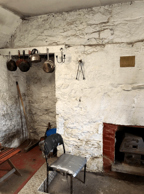
Basic inside, but I’m sure in the past there’d be daily competition to stay overnight as it’s free, you can light a fire and make a hot meal, plus it’s located right in the heart of the reserve. With no-one in it, it was of course freezing.
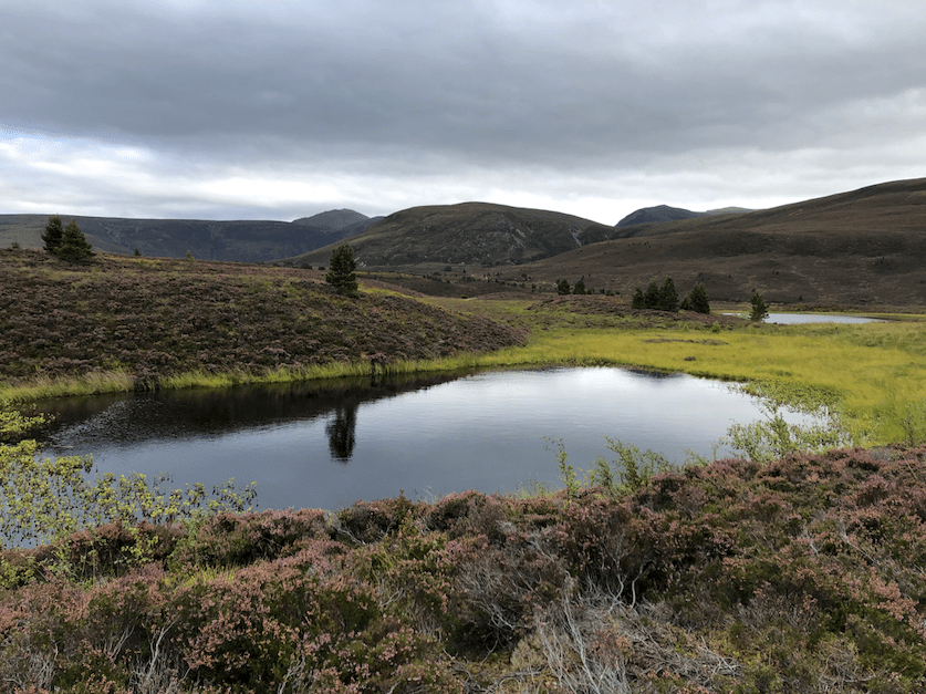
Just beyond the bothy, some lochans (aka small lakes). Storm clouds were fermenting above the landscape beyond Bynack More.

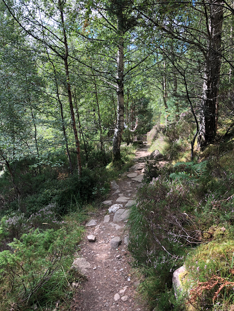
A particularly big, gnarly tree with tributaries of lichen running all over it, lining the path through ancient Caledonian pine forest.
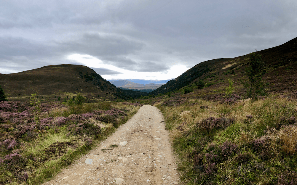
This was our view for some miles. We could have continued and eventually would have reached Loch Garten, but it was getting dusky so we turned back.
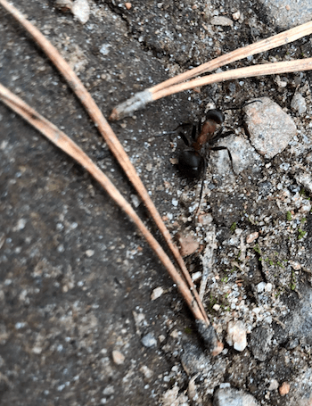
Small and rare, a few wood ants crossed paths with us through the deepest sections of the forest, bringing the total number of creatures and humans we saw on the Ryvoan Pass to four..
The clouds were still very moody as we retraced our steps back down the Ryvoan Pass.

And, while there might not have been much wildlife beyond our wild ants, there were cheery clumps of heather to encourage our weary legs to complete the last mile of ten.
- The Cairngorm Plateau

Neither myself nor my brother had walked any great distances for some time, cooped up as we’d been, and we feared that the previous day’s ten mile walk would leave us exhausted before we even reached a Munro.
Munro?
When you walk up a mountain in Scotland (anything over 3,000ft), you’re actually walking up a Munro, as that’s the Scottish name. And there are 55 of them in the Cairngorms National Park, so we had a few to choose from.
The Cairngorm Plateau is one of only two subarctic areas in Scotland (and therefore the UK), characterised by relatively dry weather year-round and with only 1-3 months displaying temperatures above 10°C.
I said relatively dry, but not entirely dry…
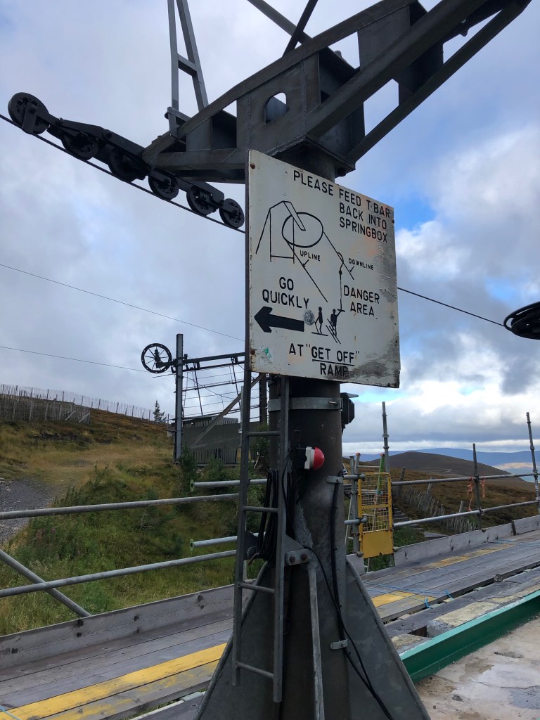
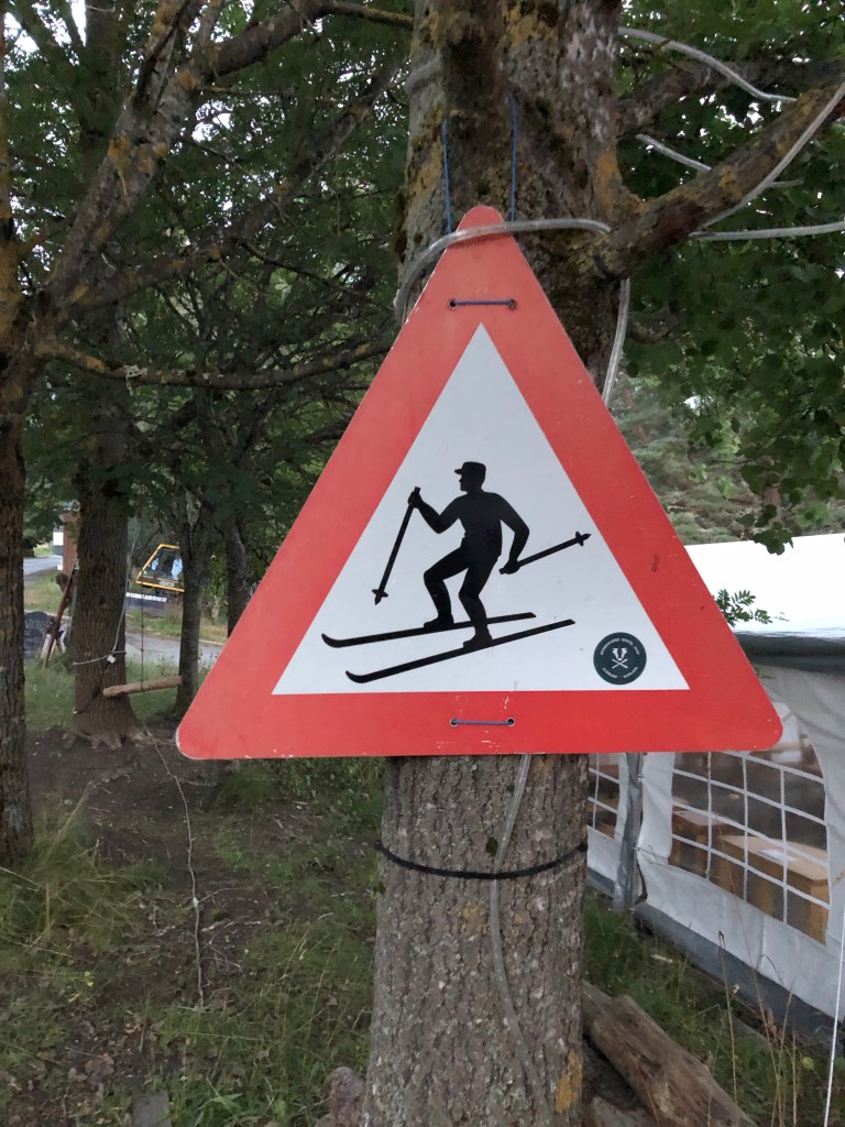
Our bus dropped us off on the mountain of Cairn Gorm itself, at the ski centre. We passed reminders of the mountain’s winter occupation at the very start.

9.45am in the morning and we’d already nearly had our heads blown off on the aptly named ‘Windy Ridge’ path. Here, it was clear that the only way was up. (And note the excellent paths. No matter how challenging the conditions, the paths were always excellent. Rocky boulder fields another matter perhaps..)
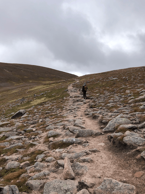
The first Munro we were aiming for was Ben Macdui, the second highest mountain in Scotland no less. We kept expecting steep sections, but our route upwards was gradual enough that we weren’t too out of breath.

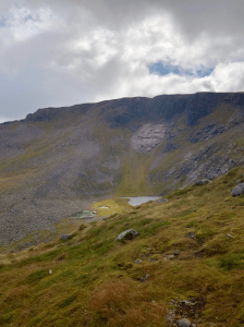
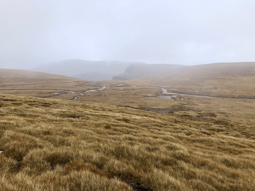
It took a while for it to come into view, but after half an hour, we could look down into Coire an Lochain, formed through erosion by glacial ice.

Low-lying mists and clouds were the cause of our right sides getting completely soaked as we walked above the coire, feeling closer to the summit of Ben Macdui.

There was a sting in the tail of course. The mountain’s sides seemed to be one huge boulder field, featuring lots and lots and lots of boulders.
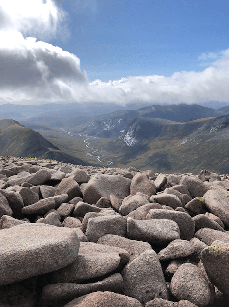
Our reward at the top of Ben Macdui.
We strayed away from those getting pictures next to the cairn at the peak, and instead found these stupefying views overlooking the winding curves of the Allt Clach nan Taillear river. I wrote in my diary that it made me think of the Amazon river, and it does still.
Higher up and into the early afternoon, the weather it was a-changing.
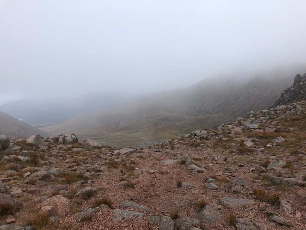
This look like a premium picnic spot to you? After completing another Munro (already at such an elevation, it wasn’t much effort), we stopped for lunch near this Mars-like mountain edge, in icy, pouring rain… though we found a few rocks to shelter by, it remained appallingly cold nonetheless.

A brief respite as we resumed our walking. Before ferocious winds bit again, further on..

The weather really starting to close in, we decided not to climb the last Munro, Cairn Gorm Mountain itself, where we’d started. We knew we’d made the right decision, as it was tough going down even on the paths, which were some of the best made we’d encountered on the whole hike.
We walked as fast as we could (given the conditions), hoping to catch the last bus of the day…

And it was about here, on paths designed to be skied on in winter months, that we saw the bus pull up in the distance. Oh well.
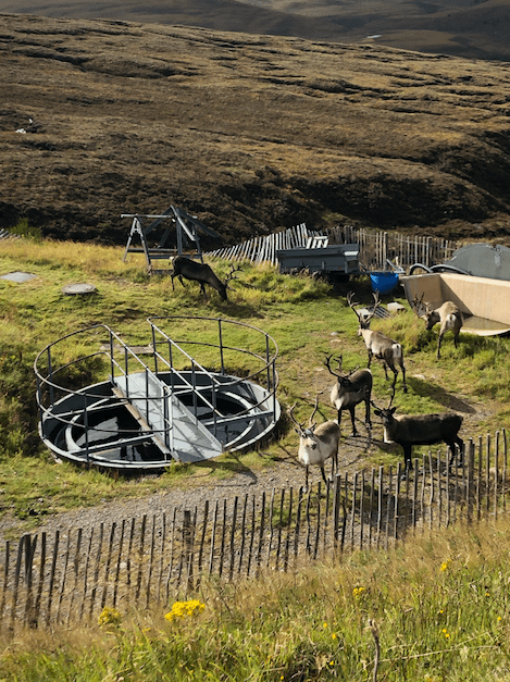
Reindeer!
A silver lining to our bad luck on the bus front. Cairngorm’s reindeer are Britain’s only free-ranging herd and they’ve been roaming 10,000 mountainside acres since 1952 – introduced by a Swedish couple to show that they could thrive again in Scotland, 800 years on.
The reindeer herd numbers about 150 and in normal times you can take officially-run guided hill trips to see them.
Sadly we saw no sign of a sleigh, which might have been a help as we had some walking to do yet to get back to our hostel…
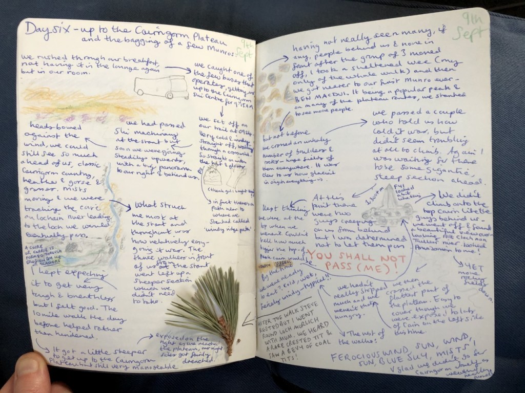
My travel diary from the day of our hike.
- If you ever need some provisions (scran)…

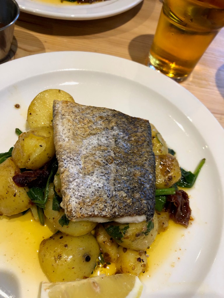
No better way to spend the evening after a big walk (or ski) in the Cairngorms than at the Pine Marten Bar – also a shop, restaurant, snow sports hire and eco lodge spot! It was so popular inside the Pine Marten Bar to begin with that we thought we might have to be outside all evening, but we thankfully got a (socially-distanced) table just in time for dinner. All locally sourced grub, and the staff are the best.
Despite all the snow, the Pine Marten Bar sadly have no customers to serve, or rent skis and cabins to, because of the latest lockdown. But they’re doing their best to keep themselves busy – they’ve got their very own ‘snowbadger’ snow park which featured on yesterday’s Ski Sunday!
They’re a great follow on Instagram too.
